


Over 70.000 POIs from the ActiveCaptain community of boaters, to make your marine navigation safer and relaxed. Marinas, hazards, anchorages and local knowledge all this at a finger tip.
Settings page
From the main Settings page you can open the ActiveCaptain Settings page.
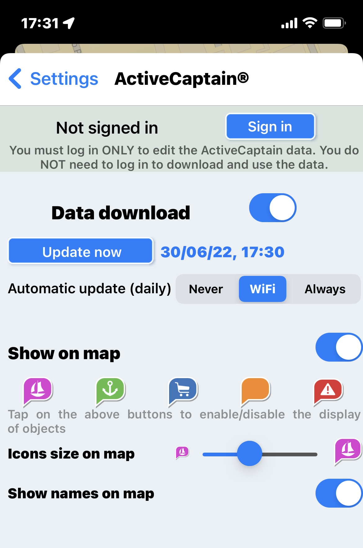
- Sign in: to login in the ActiveCaptain account. To display and access the data it is not needed to login to the ActiveCaptain account, it is needed only if you would then edit the data.
- Data download: to enable the ActiveCaptain functionality and download the data for offline use.
NOTE: the first time you download the data, it will require some minutes, while you can continue using the app. - Update now: to immediately download the latest available database.
- Automatic update: you can choose the automatic update logic: "Never" will never update automatically the database (you shall press manually the "Update now" button), "WiFi" will do an automatic daily update each time the app is active and connected to a WiFi network and "Always" is doing the update (daily) with any type of data connection (even cellular connection).
NOTE: with the "Always" option you can have extra costs depending on your mobile contract. - Show on map: to enable the drawing on the map of the ActiveCaptain objects. You can also fine tune what to draw on the map using the 5 icons below: marinas, anchorages, business, local knowledge (boat ramps, bridges, dams, ferries, inlets and locks) and hazards. Tapping on the specific icon will enable/disable the drawing of the corresponding set of objects.
NOTE: these settings will impact also the Route Explorer search engine. The objects that are not displayed will not be found by the Route Explorer engine. - Icon size on Map: to select the preferred icon size of the ActiveCaptain objects on map.
- Show names on map: to enable the drawing of the objects name on the map (just below the corresponding icon).
NOTE: when enabled, the names will be drawn only at detailed scales.
Object info page
To get all the details of an object, tap on the corresponding icon on the map and select the and you will open the relative info page.
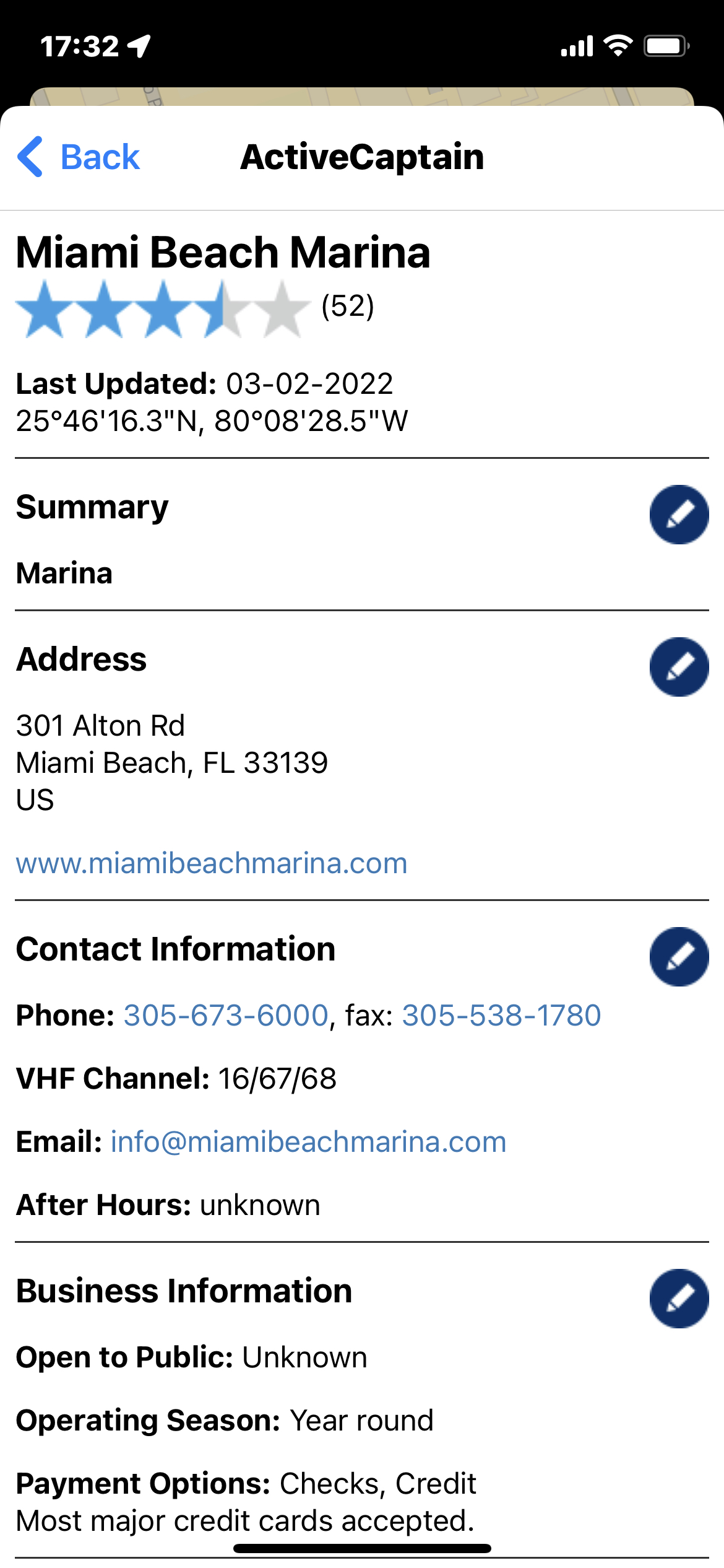
For each object there are different information available like name, description, opening time, etc. and the rating by other users.
From this page you will be able, other than consulting the info, to edit all the information and to edit/add a review.
- Edit: press the pen icon
 to edit any section.
 - Review: tap on "Write review" (or "Write comment") at the bottom of the page, to enter a review.
- Delete: to delete an object you shall edit the Summary section and then select the "Delete Marker" button.
Create a new Object
To create a new ActiveCaptain marker you shall first of all create a new marker (or use an existing one).
After you create the marker in the right position, open the Marker info page and select the icon from the bottom menu.
You will be asked to confirm the choice and then which type of ActiveCaptain object you would create.
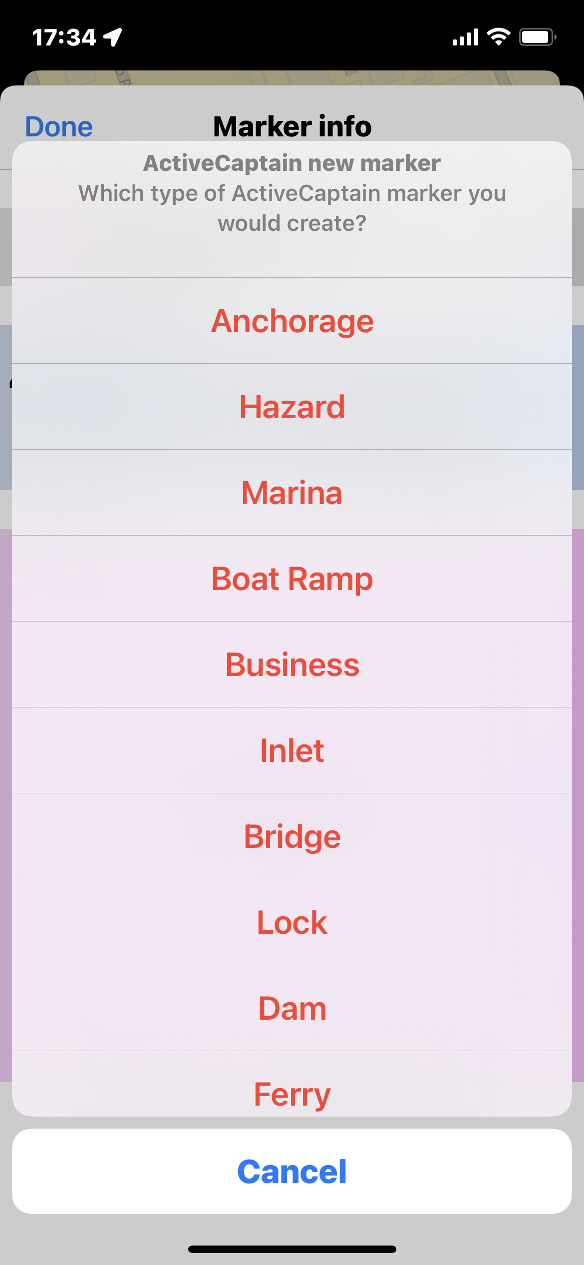
The new ActiveCaptain marker will be created at the same position of the Aqua Map marker and with the same name.
After that, the page will close and the ActiveCaptain Object info page (see above paragraph) for the newly created object will open and you will be able to edit all the object's data.

