

Aqua Map Blog
"Did you know? Getting a Gulfstream Forecast Overlay in Aqua Map"
by Ted Arisaka
2021, June 21st

I'm a recreational sailor based out of Hilton Head, South Carolina. We normally sail south in the winters on our Valiant 42 s/v Little Wing and head over to The Bahamas. But 2020 has been anything but normal. Whether crossing to The Bahamas or transiting the East Coast waters when I crew on deliveries, it is helpful to have a Gulf Stream forecast. Here is some documentation I put together to overlay it in Aqua Map:
One of the neat features of Aqua Map is the ease in which one can share data - such as Bob423’s routes and tracks. One can also import KMZ files from Google Earth. So I got excited to try to import NOAA Gulf Stream prediction KMZ files, but alas this does not work as the NOAA product is a simple graphic overlay and not in vector format. I reached out to NOAA and they told me they were working on modernizing the formats of their products.
However, I stumbled upon a youTube tutorial created by David Burch of @StarpathNav on how to import NOAA’s ASCII data product and create a GPX file. In his example he ultimately displays it in openCPN, but I will use Aqua Map. Here is his video https://youtu.be/cRyJjp0IADQ but I’ve also outlined the steps below:
Repeat individually for N and S walls of the Gulfstream
1) Obtain the forecast from the NOAA website in ASCII format
2) Reformat this ASCII data so it can be converted into GPX in a word processor
3) Upload the reformatted ASCII data into the GPS Visualizer website & convert to a track in GPX format
4) Download the GPX File and open it in Aqua Map
1) Obtain the forecast from the NOAA website in ASCII format
Goto NOAA’s Ocean Prediction Center Website for Gulf Stream Imagery and Data
https://ocean.weather.gov/gulf_stream.php
Select “Gulf Stream ASCII Data”

There are two walls of the Gulfstream North and South (sometimes called W and E). First select just the data starting from under the header “RMKS/1. GULF STREAM NORTH WALL DATA FOR 27 JUN 19:”

Up until the start of the ASCII data for the 2nd wall and COPY that.

2) Reformat this ASCII data so it can be converted into GPX in a word processor
Open you favorite word processor (Google Docs, Pages on iPad etc) and paste in this data. Perform a “Find and Replace”

Find “W” and replace all with “W,”. We are adding a comma after each “W”.
Then repeat with “N”. Find “N” and replace all with “N,”.
You now have the dataset ready to convert using an online utility that will put it into GPX format. Select ALL and Copy.

3) Upload the reformatted ASCII data into the GPS Visualizer website & convert to a track in GPX format
Goto https://www.gpsvisualizer.com/and click “Convert to GPX”
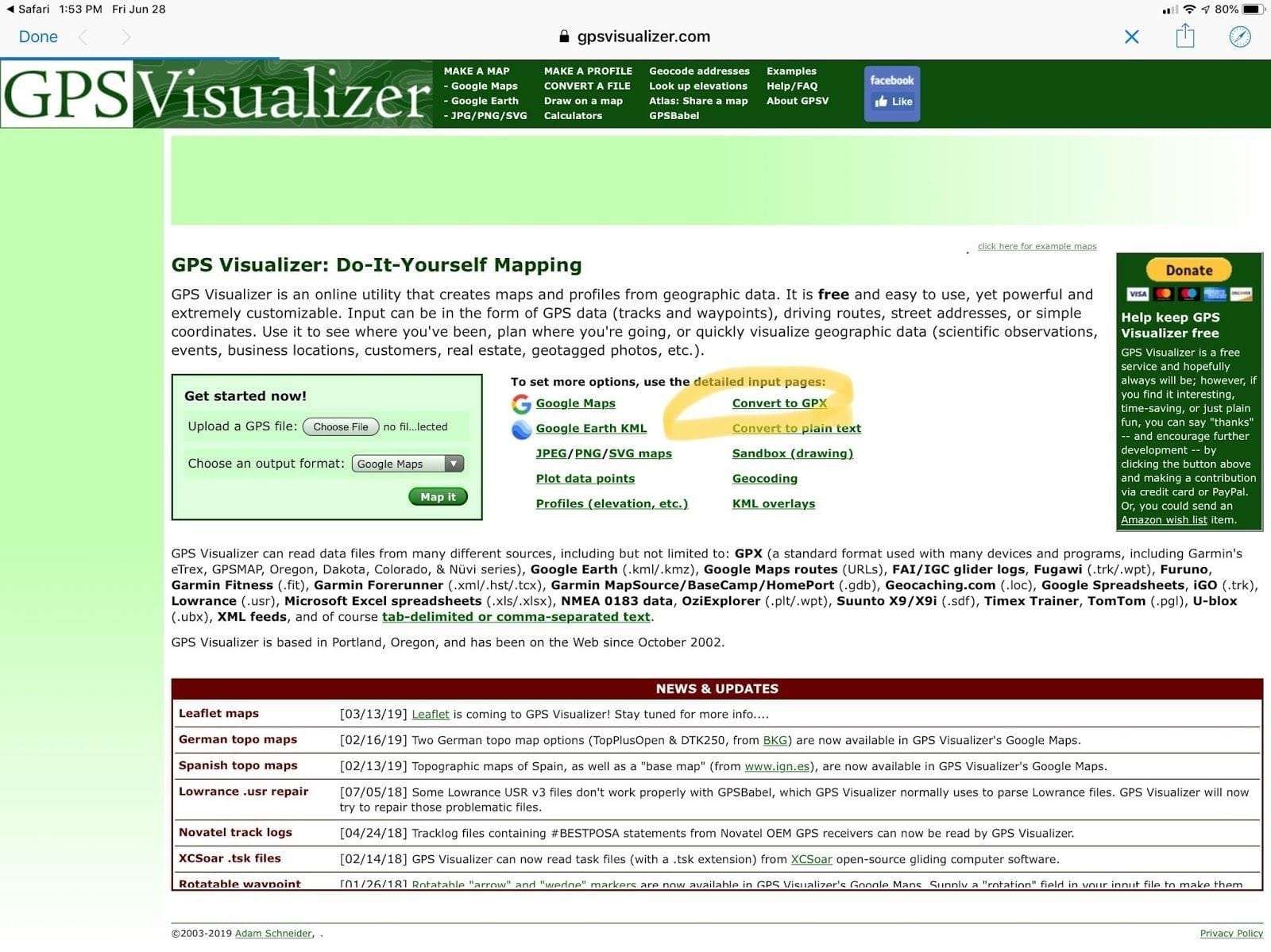
As our formatted data set is comma-delimited, we need to select this option. Other choices can remain as default.


The utility needs a header to tell it what each field corresponds to. Manually type in “Latitude, longitude,” & then “Paste” the data from step 3 into specified box. And click “Convert”.

4) Download the GPS File and open it in Aqua Map
Select “Click to download….”
If you’re using a Safari browser on an iPad, you should get the following. Click “Open in Aqua Map”. If that option is not there, select “More…” and find the Aqua Map app.

Aqua Map should open and ask you if you want to import the track, select “Import”

And you should see the North Wall of the Gulf Stream as a track

Now repeat these steps for the South Wall of the Gulf Stream. Done.